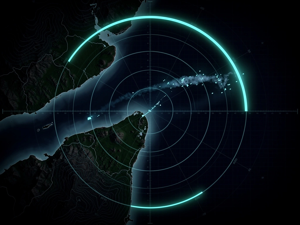
Butterworth Radar
Sixty-four minutes separate MH370's last transponder return from its first satellite handshake. Radar kept finding it across sixty-one of them, and Malaysia's own final report says the air force knew what it was watching.
At 17:21:13 UTC on 7 March 2014, 3.2 nautical miles past the IGARI waypoint, the radar position symbol for Malaysia Airlines Flight 370 dropped off the screen at Kuala Lumpur Area Control Centre. At 18:25:27 UTC, the aircraft's satellite data unit logged back on to an Inmarsat ground station outside Perth. Between those two timestamps sit sixty-four minutes that most retellings of the disappearance compress into a single sentence about a plane vanishing.
Radar kept finding MH370 across sixty-one of those minutes, in a series of contacts rather than one unbroken trace. A civilian terminal approach radar at Kota Bharu and a military long-range air defence radar both recorded it turning back across the Malay Peninsula and running northwest into the Strait of Malacca, and the Malaysian government's final report states that on the day of the disappearance the air force recognised the target as MH370 and decided not to intercept it.
That statement sits in section 1.1.4 of the Safety Investigation Report, under the heading "Role of the Malaysian Military", and it has been public since 30 July 2018. What follows is the record of those sixty-four minutes at the precision the official reports themselves use: seconds, not approximations. It matters because the positions in that record, and only the positions, are what the search that followed was built on.
1 The Last Forty-Two Seconds of Cooperative Tracking
MH370 passed over waypoint IGARI at 17:20:31. Five seconds later its Mode S transponder symbol dropped off Malaysian air traffic control radar. Thirty-seven seconds after that, at 17:21:13, the last secondary surveillance radar position was recorded. A matching secondary target on Vietnamese radar at Conson Island had already gone: the ATSB puts that at 17:20:33, the Malaysian report at 17:20:59, and neither addresses the twenty-six seconds between them.
Secondary radar works as a conversation rather than an echo. The ground station interrogates, a transponder aboard the aircraft answers with its identity and altitude, and that reply is what puts a labelled symbol on a controller's screen. Stop the transponder answering and the aircraft stops existing as far as that system is concerned.
The last human voice from the flight deck came a minute earlier. Kuala Lumpur had instructed the crew at 17:19:26 to contact Ho Chi Minh control on 120.9 MHz, and at 17:19:30 the pilot in command acknowledged: "Good night Malaysian Three Seven Zero." Nothing was heard from the aircraft again.
So the aircraft didn't disappear at 17:21:13. Its transponder did. Everything in this article after that timestamp comes from primary radar, which bounces a pulse off the airframe and needs no cooperation from anyone aboard, and that distinction is the only reason a track exists at all.
- Safety Investigation Report MH370 (9M-MRO), MH370/01/2018, section 1.1.1, p. 2, and Figure 1.1A, p. 5 : The Malaysian ICAO Annex 13 Safety Investigation Team for MH370, issued 2 July 2018. The handover instruction, the acknowledgement and the IGARI passage are in section 1.1.1; the military radar section 1.1.3 begins on p. 3.
- The Operational Search for MH370, ATSB AE-2014-054, p. 10 : 3 October 2017. The ATSB renders the final transmission "Good night Malaysia Three Seven Zero"; the Malaysian report, which held the radiotelephony transcripts, renders it "Malaysian".
2 What the Primary Radar Saw
At 17:30:37, nine minutes after the transponder stopped, a primary target appeared on the Kuala Lumpur ACC display coded P3362. It came from the terminal approach radar sited south of the runway at Kota Bharu's Sultan Ismail Petra Airport, a civilian installation on Malaysia's east coast. Over the next twenty-two minutes that civilian radar caught the aircraft four separate times and lost it four separate times.
- P3362, from 17:30:37 to 17:37:22
- P3401, from 17:38:56 to 17:44:52
- P3415, from 17:47:02 to 17:48:39, which the report calls "the continuity of the same target"
- P3426, from 17:51:45 to 17:52:35, appearing south of Penang Island
Intermittency like that is normal for primary radar at range. The pulse has to travel out, reflect off metal, and come back strong enough to register against clutter. A target drifting toward the edge of usable coverage fades in and out. The ATSB put the point plainly in its final report: the recorded primary radar data "was not continuous", but the target "could be followed with no ambiguity with other radar returns in the area."
The military radar carried the track much further. It picks up at 17:21:13 with the return turning right and then holding a constant left turn onto a heading of 273 degrees, running parallel to airway M765 back toward Kota Bharu. By 17:37:59 the target is on 239 degrees, parallel to airway B219, pointed at the Penang VOR. At 17:52:31 it's ten nautical miles south of Penang Island on 261 degrees. Then it turns northwest.
The ATSB's reconstruction of the ground track names the waypoints. From IGARI the aircraft made a roughly 40-degree turn right, then a 180-degree turn left to track back across the peninsula toward Penang, passing over or near ABTOK, KADAX and GOLUD (all within three nautical miles of each other) and later PUKAR. South of Penang it made a slow right turn, headed northwest, and eventually settled onto published air route N571 from waypoint VAMPI.
That last stretch got checked. Investigators verified the N571 section of the radar data against the track of a commercial flight that followed the same route about 33 nautical miles behind MH370, which is the kind of control you want before building a search on a radar trace, and it held up.
The track ends at 18:22:12, roughly ten nautical miles past waypoint MEKAR and about 195 nautical miles from Butterworth. Three minutes and fifteen seconds later, the satellite data unit logged back on. No radar anywhere detected the aircraft again.
The 64 Minutes, Second by Second
All times UTC. Malaysia local time is UTC+8. Every row is drawn from one of the two official reports.
| Time | Recorded event | Source |
|---|---|---|
| 17:19:30 | Last radio transmission. The pilot in command acknowledges the handover to Ho Chi Minh with "Good night Malaysian Three Seven Zero". | SIR p. 2 / ATSB p. 10 |
| 17:20:31 | MH370 passes over waypoint IGARI. | ATSB p. 10 |
| 17:20:33 | Matching secondary target at Conson Island, Vietnam, no longer detected, per the ATSB. The Malaysian report twice gives this as 17:20:59, a 26-second disagreement neither report addresses. | ATSB p. 10 / cf. SIR pp. 3, 15 |
| 17:20:36 | Mode S transponder symbol drops off Malaysian ATC radar. | SIR p. 5 |
| 17:21:13 | Last secondary surveillance radar position, 3.2 nm past IGARI. Military radar shows the return turning right, then holding a constant left turn onto heading 273 degrees. | SIR pp. 4-5 |
| 17:24:57 to 17:37:35 | Military data records heading changes of 8 to 20 degrees, ground speeds of 451 to 529 kt, and heights from 31,150 to 39,116 ft. | SIR p. 4 |
| 17:30:37 | Civilian primary target P3362 appears on the KL ACC display, captured by the terminal approach radar south of the Kota Bharu runway. | SIR pp. 6, 18 |
| 17:37:22 | P3362 disappears. | SIR p. 6 |
| 17:37:59 | Military data has the target on heading 239 degrees, parallel to airway B219 toward VOR Penang. | SIR p. 4 |
| 17:38:56 | Civilian primary target P3401 appears. | SIR p. 7 |
| 17:39:06 | Ho Chi Minh ACC queries Kuala Lumpur ACC on the whereabouts of MH370. | SIR p. 3 |
| 17:44:52 | P3401 disappears. | SIR p. 6 |
| 17:47:02 | Civilian primary target P3415 appears, "the continuity of the same target". | SIR p. 7 |
| 17:48:39 | P3415 disappears. | SIR p. 7 |
| 17:51:45 | Civilian primary target P3426 appears south of Penang Island. | SIR pp. 7, 18 |
| 17:52:27 | First officer's mobile telephone detected by the tower at Bandar Baru Farlim, Penang. The ATSB records "no record of communications having been made or attempted using this telephone". | ATSB p. 10 |
| 17:52:31 | Military data has the target 10 nm south of Penang Island, heading 261 degrees, 525 kt, 44,700 ft. | SIR p. 4 |
| 17:52:35 | P3426 disappears. Last civilian primary radar return. | SIR p. 7 |
| 18:01:59 | Military data has the target near Pulau Perak, heading 022 degrees, 492 kt, 4,800 ft. | SIR p. 4 |
| 18:03:09 | The military return disappears. | SIR p. 4 |
| 18:15:25 | The military return reappears. | SIR p. 4 |
| 18:22:12 | Final primary radar position, 10 nm past waypoint MEKAR on airway N571 and about 195 nm from Butterworth. Heading 285 degrees, 516 kt, 29,500 ft. No radar detects the aircraft again. | SIR pp. 4, 6 / ATSB p. 10 |
| 18:25:27 | The satellite data unit initiates a log-on to the Inmarsat I-3 satellite, three minutes after the last radar return. | ATSB p. 11 |
- Safety Investigation Report, section 1.1.3(1) Malaysian Military Radar and 1.1.3(2) DCA Civilian Radar Data from Kota Bharu, pp. 4-7 : The report lists the third civilian target as P3415 on p. 7 and as P3451 in the Kuala Lumpur ACC Radar section on p. 18. Times are identical in both passages.
- The Operational Search for MH370, ATSB AE-2014-054, "Waypoint IGARI to waypoint MEKAR", p. 10
3 The Altitudes Everyone Quotes Are the Ones the Reports Threw Away
The Safety Investigation Report records the military radar's height readings on the westbound leg as ranging from 24,450 to 47,500 feet, and its ground speeds from 532 to 571 knots. Those figures have fed a decade of public argument about steep climbs, dives, evasive manoeuvring and deliberate depressurisation. Neither investigation treated them as measurements.
The Malaysian report disposes of them on page 4, before it presents a single radar timestamp. Recorded altitude and speed changes from blip to blip were "well beyond the capability of the aircraft". Altitude and speed extracted from the data are, in the report's words, "subjected to inherent error". Then comes the sentence that ought to end the argument: "The only useful information obtained from the Military radar was the latitude and longitude position of the aircraft as this data is reasonably accurate."
The ATSB started in the same place and didn't stay there, and the difference is worth getting right. Describing how the northern and southern routes were first developed, its appendix records that "at this time only the location data was used in the final location analysis as the accuracy of the speed and altitude information was not known." Later in that same appendix the ATSB does lean on the radar for speed: Boeing's finding that the aircraft accelerated from 473 to 500 knots crossing the peninsula and the Strait "was confirmed by the last two Royal Malaysian Air Force air defence radar returns."
So the two bodies part company on speed, and agree completely on altitude. Nobody used the heights. The ATSB's own summary of what the primary radar was good for puts speed, location and altitude at the same low grade, saying the "limited fidelity" of the tracking data allowed all three "to be approximated", and no altitude figure from that dataset appears in either investigation's reconstruction of the flight.
Malaysia went further and tested it. Investigators took the military radar profile into a Boeing 777 simulator and tried to fly what the data described. The report's finding runs to one sentence: "Some of the speed and height variations were not achievable even after repeated simulator sessions."
One row shows how strange the dataset gets. At 18:01:59 the military track has the target near Pulau Perak on a heading of 022 degrees at 4,800 feet, doing 492 knots. Twenty minutes later, at 18:22:12, the same track has it on 285 degrees at 29,500 feet. The altitude and the speed there fall under the report's own disclaimer, so neither is worth arguing about, but the heading doesn't: the report disclaims altitude and speed and says nothing at all about heading accuracy. A north-northeasterly bearing sits oddly in a flight path running west-northwest up the Strait of Malacca, and the report prints both values and moves on without reconciling them.
Anyone building a theory of MH370's last hours on that altitude profile is building on numbers the people who collected them told you not to use. That cuts in every direction: it undercuts the depressurisation reconstructions and the evasive-manoeuvring readings alike. The positions are the evidence here, and the heights are instrument error with a decimal point on them.
- Safety Investigation Report, section 1.1.3(1), pp. 4-6 : The sentence beginning "well beyond the" breaks across pages 3 and 4; "capability of the aircraft", "subjected to inherent error" and "the only useful information" all sit on p. 4. Simulator reconstruction finding, p. 6.
- The Operational Search for MH370, ATSB AE-2014-054, p. 10 and appendix, "Development of Northern and Southern routes" / "Refinement of initial assumptions" : The appendix qualifies the location-only statement with "At this time"; the 473-to-500 kt confirmation from the last two RMAF returns appears later in the same appendix.
4 Whose Radar Was It
Here's a detail the popular account gets wrong, including the name at the top of this page. The Safety Investigation Report never says where the military radar was. Across the entire military radar section it calls the instrument "the Military long range air defence radar with Primary Surveillance Radar (PSR) capabilities" and credits its figures to the Royal Malaysian Air Force. Butterworth appears once in that section, and only as a ruler: the final position is given as "about 195 nm from Butterworth".
The ATSB is more specific and points somewhere else. Its final report describes "a civilian PSR at Kota Baru in the north of Malaysia and a military PSR on Penang Island". RMAF Butterworth is an air base on the mainland, in Seberang Perai, across the Penang Strait from the island. A radar head on Penang Island and an air base at Butterworth are two locations, and neither report reconciles them or names the station that produced the track.
None of this changes what was recorded. It changes how precisely anyone can describe who recorded it, and that distinction is worth holding onto, because the further this story travels from the two reports the more confident it gets about details neither report contains. Why does an investigation that ran to 449 pages decline to name the radar station that produced its longest track of the missing aircraft?
5 They Knew What They Were Looking At
Section 1.1.4 of the Safety Investigation Report runs to a single paragraph, and it's the most consequential thing the document says about that night's radar.
"On the day of the disappearance of MH370, the Military radar system recognised the 'blip' that appeared west after the left turn over IGARI was that of MH370. Even with the loss of SSR data, the Military long range air defence radar with Primary Surveillance Radar (PSR) capabilities affirmed that it was MH370 based on its track behaviour, characteristics and constant/continuous track pattern/trend. Therefore, the Military did not pursue to intercept the aircraft since it was 'friendly' and did not pose any threat to national airspace security, integrity and sovereignty."
Read that against the version of this night that circulated for years, in which Malaysian air defence tracked an unidentified contact across sovereign airspace and nobody worked out what it was until days later. The official report says the opposite. The identification was made from the track itself, and the non-interception was a decision that followed from it rather than a failure to notice.
One caution on how precisely to read it. The report says "on the day of the disappearance", which is a date rather than a moment, so it doesn't literally state that the identification happened minute by minute as the aircraft crossed the country. What pins it closer is the decision the same sentence describes: you can only decline to intercept an aircraft while it's still flying, and the report's own findings list records separately that "the aircraft primary radar target was designated as 'friendly' by the Royal Malaysian Air Force". A designation and a non-interception are both contemporaneous acts. That's the inference, and it's a short one, but it is an inference rather than a quotation.
Ashton Forbes has made the detection half of this argument across multiple videos since 2024, crediting the journalist Florence de Changy, whose work the French judicial investigation page covers in more detail. His framing is that a military base sitting beside the aircraft's track could not plausibly have missed a Boeing 777: "there's no chance they wouldn't have tracked the plane." On the detection, the Malaysian government's own final report agrees with him, and it agrees in stronger terms than he uses, because it says the air force didn't merely see the target, it identified it.
Where the record stops short is the inference some draw next. A stated reason for not intercepting ("it was friendly") isn't the same as an account of who was told, when, and what was done with the information, and section 1.1.4 supplies the first and none of the rest. It's a real answer to a real question, and it opens three more.
- Safety Investigation Report, section 1.1.4 "Role of the Malaysian Military", pp. 19-20
- Ashton Forbes, MH370 - Redacted Interview & Mentour Pilot Reactions (Vt5-EiU3DXA), 17 April 2024 : Auto-caption renders the base name "Buttersworth". Claim also appears in hwxsgdIA750 (2 May 2024) and auFBHzzvVXA (9 July 2024).
6 Nobody Declared an Emergency for Four Hours
Ho Chi Minh ACC noticed within eighteen minutes. At 17:39:06 Vietnamese controllers queried Kuala Lumpur about the whereabouts of MH370, and Kuala Lumpur called Malaysia Airlines operations to ask where the aircraft was. Ho Chi Minh also contacted Hong Kong and Phnom Penh trying to locate it. No air traffic control unit established contact.
The Safety Investigation Report's assessment of what should have happened next is a finding against Malaysia's own controllers: Kuala Lumpur ACC should have declared the Distress Phase at 18:27. It was declared at 22:32. Kuala Lumpur's Aeronautical Rescue Coordination Centre was activated at 21:30, and the report notes there's no evidence Ho Chi Minh ever activated its own rescue coordination centre at all.
Four hours and five minutes passed between the moment the report says a distress phase was warranted and the moment one was declared.
That gap belongs in any honest account of the night, and it belongs here rather than in a theory of what happened to the aircraft, because it's documented by the investigating body against itself. Whatever was in the air over the Strait of Malacca at 18:22:12, the response on the ground had not yet started.
- Safety Investigation Report, section 1.1.2 Actions by HCM ACC and KL ACC, p. 3, and the analysis of the ATC response in section 2 : DETRESFA declared 22:32 UTC; KL ARCC activated 21:30 UTC (both p. 3); the finding that KL ACC should have declared the Distress Phase at 18:27 UTC is in the analysis section.
- The Operational Search for MH370, ATSB AE-2014-054, p. 10, footnote 11 : The ATSB dates the first contact attempts from 17:39:03 and gives the formal distress phase as 22:32:00, consistent with the Malaysian report on the declaration and one second apart on the query.
7 The Gap Nobody Was Watching
Indonesia gets six sentences in the Safety Investigation Report, and they're worth reading closely, because they say less than they first appear to. On Medan: the radar "has a range of 240 nm, but for unknown reasons, did not pick up any radar return bearing the SSR transponder code A2157 of MH370."
Read that carefully and it's a narrower statement than it looks. MH370's transponder had stopped answering an hour before the aircraft came anywhere near Medan's coverage, so no return bearing its code is the expected result rather than an anomaly, and the report's "for unknown reasons" is doing less work than it seems to. What the report doesn't say is anything at all about Medan primary radar, which is the system that could have seen the aircraft. The gap here isn't a radar that failed. It's a question the published record never asks.
Then comes one of the report's stranger paragraphs. "The Indonesian Military however stated that they picked up MH370 earlier as it was heading towards waypoint IGARI. No other information was made available." That's the entire entry. A neighbouring air force tells an international investigation it tracked the aircraft, declines to supply anything further, and the matter closes.
MH370's final recorded position sits northwest of Sumatra, near the boundary between flight information regions, which is exactly where an aircraft is least likely to be anybody's clear responsibility. Whether Indonesian primary radar saw it there is not answered in either report, and unlike most of the holes in this case, that one somebody could still fill.
Evidence Assessment
| Claim | Source | Confidence |
|---|---|---|
| MH370 was tracked on primary radar from 17:21:13 to 18:22:12 UTC, ending 10 nm past waypoint MEKAR | Safety Investigation Report pp. 4-6; ATSB AE-2014-054 p. 10 | Established |
| Neither investigation used the radar-derived altitudes. The Malaysian report also rejected the speeds; the ATSB later used the last two radar returns to confirm a speed | SIR p. 4 ("well beyond the capability of the aircraft", "the only useful information"); ATSB p. 10 and appendix, "Development of Northern and Southern routes" / "Refinement of initial assumptions" | Established |
| The Malaysian military identified the primary target as MH370 on the day and declined to intercept because it was assessed as friendly (that the identification was contemporaneous is a short inference from the non-interception, not a quotation) | SIR section 1.1.4, pp. 19-20, quoted in full above; findings list item 7, p. 429 | Established |
| A distress phase should have been declared at 18:27 and was declared at 22:32 | SIR analysis of ATC response; ATSB p. 10 footnote 11 corroborates the 22:32 declaration | Established |
| The radar record describes an aircraft under continuous control flying a deliberate, navigable route, not an uncontrolled or disabled airframe | Track alignment with airways M765, B219 and N571 and with waypoints ABTOK, KADAX, GOLUD, PUKAR, VAMPI, MEKAR (ATSB p. 10) | Strong |
| The tracking military radar was located at or operated from RMAF Butterworth | Not stated in either report. SIR uses Butterworth only as a distance reference; ATSB places a military PSR on Penang Island | Open question |
| The Indonesian military tracked MH370 near IGARI | Asserted by the Indonesian Military to the investigation and recorded at SIR p. 18. "No other information was made available." | Unverified |
8 What the Radar Constrains
Every reconstruction of where MH370 ended up starts here, whether it says so or not. The Inmarsat handshakes give you seven arcs, and an arc is a set of positions at a distance from the satellite, not a point. Turning arcs into a search box needs a starting position, a starting time and a speed, and the only measured source for all three is the radar track that ends at 18:22:12.
The ATSB's own account of how the search area moved makes the dependency explicit. Boeing's analysis of the aircraft's movement between the last ACARS position report and the end of primary radar coverage showed it had accelerated from 473 to 500 knots crossing the peninsula and the Strait, and the ATSB records that this "was confirmed by the last two Royal Malaysian Air Force air defence radar returns." Shifting the modelled southward turn to a position slightly north of Sumatra produced a closer fit to the Doppler data at the first arc, and that single change shortened the longest candidate paths enough that two previously considered end regions no longer reached the sixth arc and were dropped.
So the radar constrains the southern Indian Ocean hypothesis by feeding it. It supplies the entry conditions, and every search zone since, including the seabed areas Ocean Infinity worked before concluding its renewed search on 8 March 2026 without finding the aircraft, was derived from a chain that begins with those positions. It's worth being clear about what that does and doesn't prove: the radar makes the southern reconstruction possible, it doesn't independently confirm it, and it says nothing whatsoever about the six hours after 18:22:12.
For the Diego Garcia reading the radar is close to silent, and honesty requires saying so. The last recorded heading is 285 degrees, west-northwest, up N571 toward the Andaman Sea, which is neither toward Diego Garcia nor away from it in any way the data settles. What happens after MEKAR is entirely a question about the satellite data, and the radar's contribution is to establish where any such path has to begin. Anyone claiming the radar track supports a specific destination is claiming more than the track contains.
What the radar does establish, and establishes firmly, is the character of the flight during the window it covers. An aircraft that turns back, crosses a peninsula, joins published airways at their waypoints, makes a slow controlled turn south of Penang and settles onto N571 is being flown. Add that the air force watching it identified it as MH370 from its track behaviour, and the picture inside those sixty-four minutes is of a deliberate, navigated flight observed by people who knew whose it was.
That's one strand, and it points the same way as several others this site has documented separately: the satellite log anomalies, the satellite and thermal footage, the debris chain of custody, and the French judicial inquiry that formed because the official account didn't survive contact with the evidence. Taken alone, a radar trace showing controlled flight is consistent with several explanations including the official one. Taken with the rest, and set against an institutional response that didn't declare an emergency for four hours after its own threshold had passed, the weight sits with the reading that far more was known at the time than was said afterwards. On the radar evidence specifically, that lean is Strong for the sixty-four minutes it covers and unsupported for everything after.
9 What Would Settle It
Neither report publishes the underlying military radar recordings. What's public is a set of derived figures presented in a government report and credited to the Royal Malaysian Air Force, which is why the altitude question can be described but not resolved from the published record: the returns those numbers came from aren't in it. Three specific things would move this on. Name the radar station. Release the recordings, or the portion of them covering 17:21 to 18:22. And put a question to Jakarta about the paragraph on page 18, because an air force that told an international investigation it tracked the aircraft and then supplied nothing further is a thread that was never pulled.
Until then the honest position is the one the documents support, which is narrower than the popular account in some places and considerably wider in others. Malaysia's air force didn't lose MH370 in the dark. It watched the aircraft cross the country, worked out what it was, decided it was friendly, and let it go, and the machinery that should have started looking for it stayed switched off for another four hours.
Related Topics
The seven handshakes that start three minutes after this radar track ends.
The wider chronology of the night, from pushback to the final handshake.
Competing reconstructions of where the aircraft went after MEKAR.
Florence de Changy's reporting and the criminal inquiry Paris opened.
The search areas these radar positions ultimately produced.
The footage that claims to show what happened after the radar lost it.